Marker, Locator Team Up to Make Underground Utilities Traceable via RFID
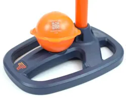
Tempo Communications recently introduced a pair of products that ease the location of buried utility lines and also can be an asset to network owners’ mapping capabilities. According to Tempo, the EML250-ID Electronic RFID Marker Locator and the OmniMarker-ID electronic RFID-enabled marker ball “create an end-to-end solution that not only locates buried assets with precision but captures, stores, and can transmit custom data directly into GIS [geographic information system] mapping platforms, transforming how utilities and contractors manage critical underground infrastructure.”
The company describes OmniMarker-ID as “a next-generation electronic marker ball that goes far beyond the passive markers contractors have relied on for decades.” Made of high-density polyethylene (HDPE), each OmniMarker-ID carries a unique, factory-programmed serial number and supports read/write capability. It can store information like asset type, installation date, service history and custom data that can be retrieved from up to 5 feet away. Its self-leveling antenna enables technicians to find the market from any orientation.
The marker ball’s companion, the EML250-ID locator combines the passive locating capability of a traditional locator with active intelligence of an RFID read/write device.
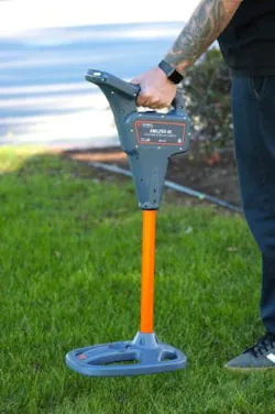
“In the field, the EML250-ID can detect and read OmniMarker-ID markers from up to 5 feet away across all 9 industry-standard frequencies,” Tempo explained. “When a marker is detected, the unit reads its unique serial number and any custom-written information stored on the marker, giving the technician instant access to asset data without any secondary lookup process. Read and write events are automatically logged by the device, providing clear traceability for auditing and compliance purposes.”
The device also passively locates any industry-standard marker ball. It features a color LCD display in varying light conditions, as well as an IP-65-rated foot and IP-55-rated housing that protect against dust and water in the field. It’s rechargeable battery provides up to 10 hours of operation under typical conditions.
The EML250-ID connects wirelessly to Tempo Communications’ Locator Link mobile app to facilitate file transfer from the locator to GIS mapping systems or cloud-based storage platforms. The locator also supports paring with GNSS (global navigation satellite system) devices, which allows a marker’s location to be captured with centimeter-level precision, and embedded into the transfer data set.
Oleg Fisher, Tempo’s vice president, commented, “The EML250-ID and OmniMarker-ID system reflects our commitment to giving field professionals not just better tools, but smarter workflows. Knowing what’s in the ground is only part of the challenge. The other part is making sure that knowledge lives in the systems where it can protect workers, inform decisions, and drive long-term infrastructure value. This system does both.”